Space Norway’s mission is to develop and operate strategic space infrastructure to meet important societal needs.
The AIS-satellites
The development and launch of satellites has traditionally been known to be very costly and complex. In recent years the development of small satellite platforms has brought forward more affordable solutions (10-30 MNOK total cost). These offer an entirely different accessibility to satellite technology and provide opportunities for using satellites to solve important assignments over Norwegian areas of interest. Satellites optimalised for coverage over other parts of the globe do not necessarily have coverage over the northern region. Therefore, the AIS-satellites were developed to broaden the Norwegian Coastal Administration’s AIS coverage to also include the coastal regions of Norway and the ocean regions in the High North.
AISSat-1
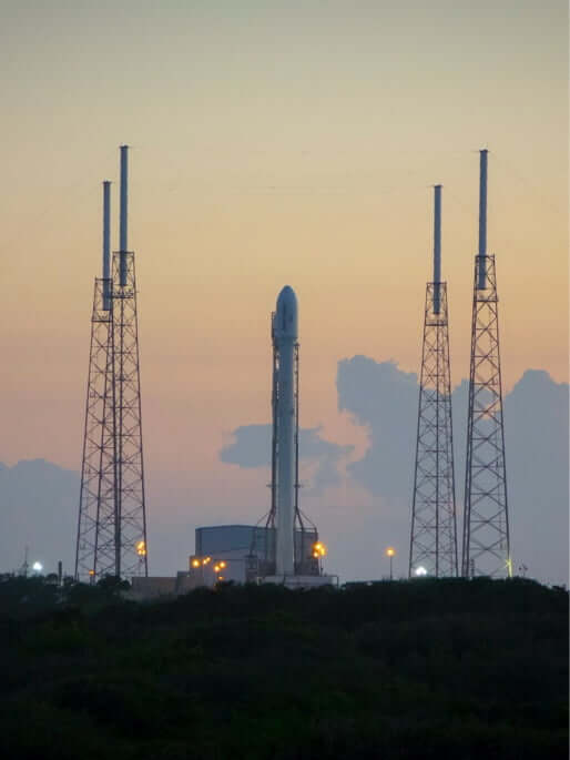
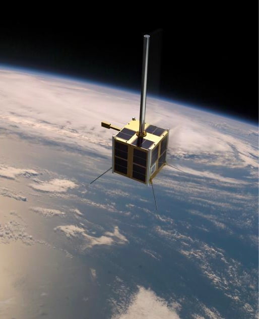
The satellite was launched from India in 2010 with the Indian rocket PSLV (Polar Satellite Launch Vehicle), and is orbiting the earth in a polar orbit at an altitude of approximately 640 km. Measuring only 20cm x 20cm x 20cm plus antennas the AISSat-1 is a small, yet highly capable satellite nonetheless and has executed its mission way beyond the expected duration of 1 year. The satellite receives and stores AIS messages during its entire orbit and transfers these data to the ground station approximately every 100 minutes, while simultaneously providing real-time surveillance of the northern region oceans.
AISSat-2
The successor of AISSat-1 was launched with the Russian rocket Soyuz from Baikonur in Kazakhstan summer of 2014, and is externally identical with the first satellite. AISSat-2 is located in a relatively similar orbit as AISSat-1, and offers the Norwegian Coastal Administration redundancy in case one of the satellites should malfunction or be temporarily out of service. Additionally, AISSat-2 increases the update frequency of AIS messages from the areas of interest.
Automatic Identification System
AIS is an anti-collision system developed for ships. It is furthermore used for general identification of ships and monitoring of their location. The requirements for using AIS on ships have been defined and are regulated by the International Maritime Organisation (IMO).
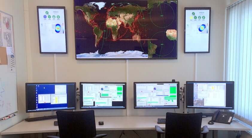
Statsat Operations Centre
Statsat has established its control center for operations at Skøyen in Oslo. The control centre has been built by the company itself, along with all the software utilised for planning missions and controlling the satellites.
The underlying philosophy has been to develop an autonomous system for planning, control and communication with ground stations and satellites requiring an absolute minimum of manual intervention and interaction. The result is a control centre without permanent staff and which automatically repairs recognizable errors and manages foreseen events.
The software system, Statsat Management And Control System, consists of both automatic and manual functions:
Automatic functions
- Weekly planning of passes and ground station usage allocation
- Communication with Kongsberg Satellite Services (KSAT) requesting access to antennas at Vardø and Svalbard
- Planning and uploading of satellite commands
- Download of satellite data, both payload data and telemetry data from the satellite platforms
- Processing of downloaded payload data and forwarding according to end-user requirements
- Checking health of satellites, ground station and ground communication network
- Automatic error correction and event logging
Manuel functions
- Analysis functions
- Statistics
- System surveillance
- Visualisation tools for analysis an presentation purposes
- Manual control functions for error analysis, bug fixing and special operations
- Logging functionality